This blog has moved to http://www.outdooradventure.jp
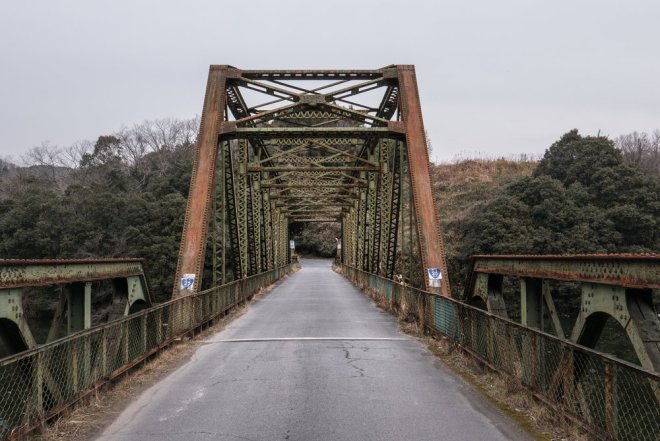
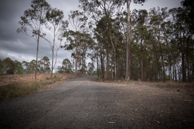
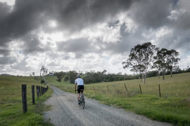
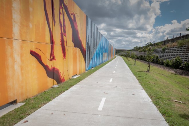
Urugi – Fujimi Panorama – Shiojiri
Urugi – Fujimi Panorama – Shiojiri
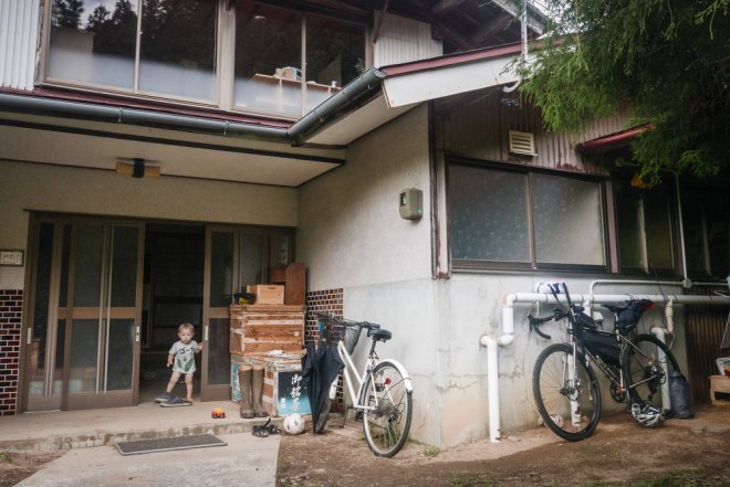
At the end of July and beginning of August I had a few days spare to do a short bike packing trip before a two week trip to Australia for work. A friend of mine, Alex, who I hadn’t seen in a while and had previously been living just outside Nagoya for more than a decade recently called time on his job, packed his bags, and moved out into the southern Nagano countryside with his young family. He moved to Urugi village (売木) which is fairly isolated and hidden away behind a number of mountain passes. Alex is planning on converting his house into a guest house for foreigners so if anybody is interested in staying please get in touch.
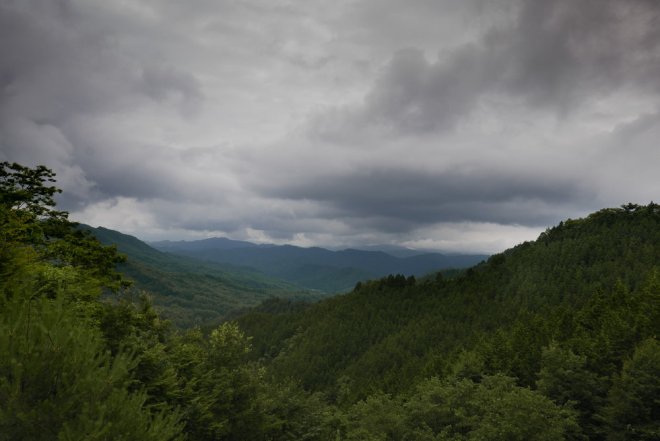
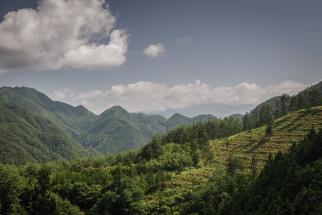
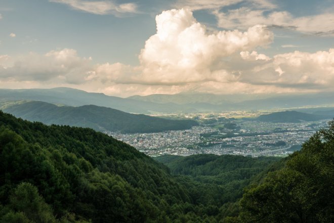
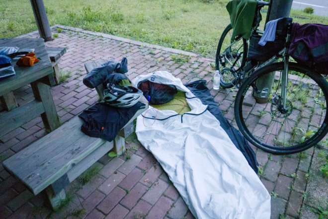
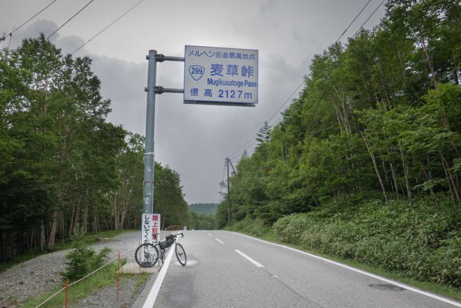
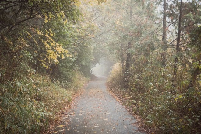
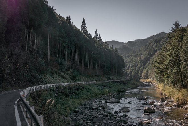
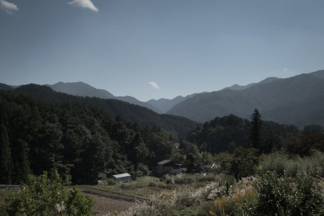
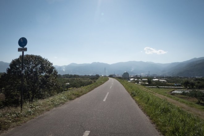
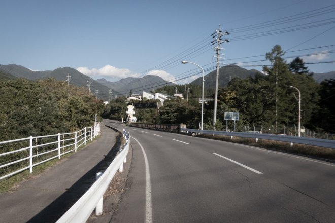
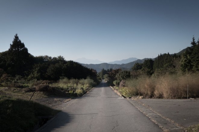
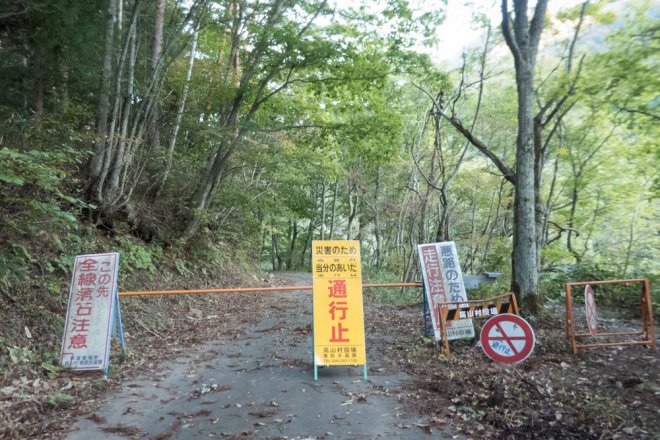
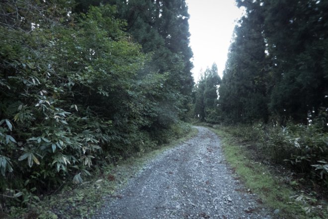
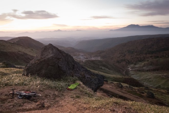
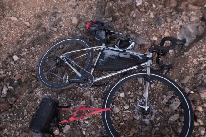
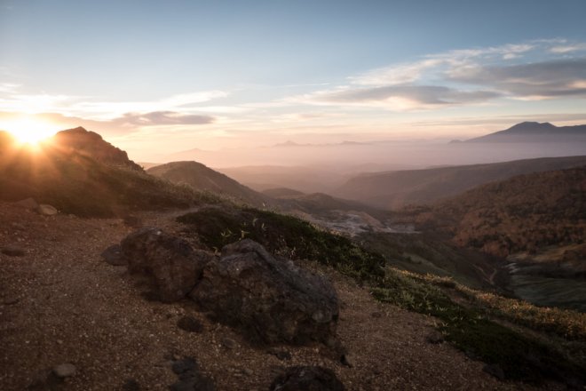
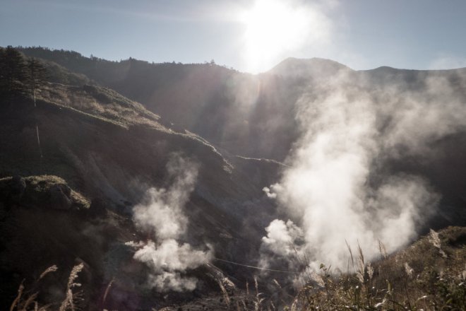
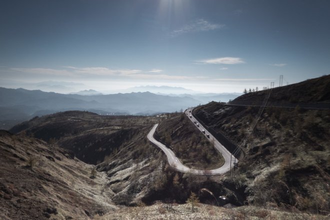
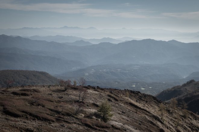
With that in mind I chose to plan a route that took in Urugi, where I could sleep the night in his traditional house, catch up on old times, and then head north to Mt. Nyukasa (入笠山) and Mugikusa Pass (麦草峠) in central Nagano. I originally planned to head further east to Tenryu (天龍) and cycle north from there but the road was closed due to a landslide. There was also a summer lightening storm when I arrived at the base of Mt. Nyukasa so it wan’t wise to ride up that either. However, I still managed to camp rough at Fujimi Panorama (富士見パノラマ), a popular mountain biking park/ski resort, and head up Mugikusa Pass the following day. I stashed all my gear in a bush at the bottom of the climb before heading up to 2128m. It was a climb I’d done on numerous occasions before so knew what to expect. Despite reaching more than 2000m the gradient never gets too difficult. On a clear day you are rewarded with some wonderful mountain views.
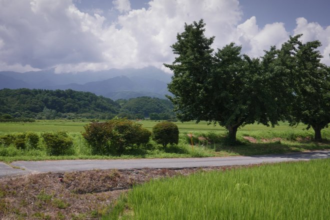
From the top of the pass I turned around, descended into Suwa (諏訪) and headed to Shiojiri (塩尻) where I caught the Shinano Express back to Aichi.
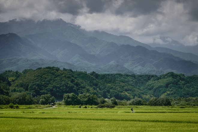
A short, cheap trip, but satisfying and as usual there was some breathtaking scenery.
Autumn is the perfect time of year for bike packing in Japan so expect some new routes/rides to appear here in the coming months.
Shiojiri – Nagoya train fare – ¥5180
Camping – free
Day One – Kasugai – Urugi
Distance – 94kms
Total elevation – 2250m
https://rwgps-embeds.com/embeds?type=route&id=25329732&metricUnits=true&sampleGraph=true
Day Two Urugi – Fujimi Panorama
Distance – 134kms
Total elevation – 2000m
Day Three – Fujimi Panorama – Shiojiri
Distance – 96kms
Total elevation – 1860m
Shimanami Kaido with First Over Everything
Bike Packing Japan hasn’t had a chance to ride the iconic Shimanami Kaido (しまなみ海道) route yet but Bradley from First Over Everything has and he made a video this time last year.
As it’s one of the most popular rides in Japan for foreign tourists it’s well worth taking the time out to watch.
As I haven’t ridden it yet I’m not in a position to offer advice on where to stay etc but as it’s so popular logistic shouldn’t be a problem.
Ride With GPS Ambassador
Bike Packing Japan & Ride With GPS
I’m pleased to announce that Bike Packing Japan is now a Ride With GPS ambassador. It’s still early days and there is only one route online at the moment but you can find our profile page here.
Route Finder Map Added
Just a quick note to say that I’ve added an interactive map with direct links to the stories and routes on the website. You can find it here. Just click on a point and it should reveal a link to the story.
Thanks to Simon Wile for the suggestion.
Nagoya – Nara – Tsu
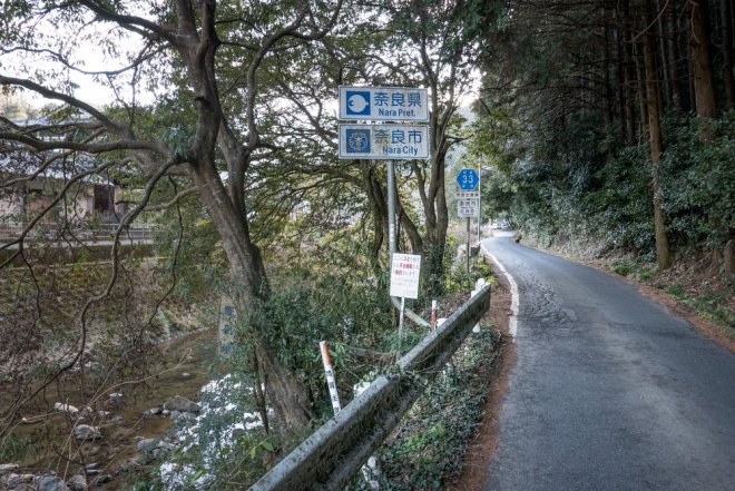
Back in 2002 I cycled from Tokushima (徳島) in Shikoku (四国) to Nagoya (名古屋) over two days on my now well-used Nishiki mountain bike. I remember the ride being in two distinct parts. Firstly, the journey from Tokushima to Wakayama (和歌山) by ferry, followed by a great day riding through the countryside of northern Wakayama and Nara (奈良) prefectures. This was a pre-Garmin, Google Maps, or smartphone time so I simply headed east until I saw signs for places I recognized and navigated my way to Nagoya. Day two also started off well as I managed for the most part to avoid an approaching typhoon before a long and fast decent via Nabari (名張) into Tsu (津) on the coast of central Mie (三重).
This is where part two of the journey commenced. It was horrible. I rode along Route 23 all the way to Nagoya on a horribly busy road in the August heat, truck exhaust fumes filling my lungs and glass and debris in all the gutters and on the pavements. Whether it’s the constant stream of trucks heading between Nagoya and Osaka (大阪) or the underwhelming scenery, there is something about the area of Japan that stretches from Nagoya to Osaka, including northern Mie, that makes cycling in the area a drag. Even Lake Biwa (琵琶湖) isn’t as much fun as the photos make out.
Of course I knew all this when I decided to plan a route from Nagoya to Nara for my first trip of 2017. Perhaps I’d missed some of the quieter, more scenic routes way back in 2002 and if planned correctly the ride could be just as enjoyable as elsewhere in Japan.
Unfortunately I was wrong. It was just as I remembered. Trucks, industrial estates, and indistinct mountain passes that wouldn’t even register in other parts of Japan. Sure, there was less traffic in places this time, but that just took away the adrenaline rush and replaced it with prolonged boredom. Iga Ueno Castle (伊賀上野城) was a pleasant distraction, especially if you like ninjas, but as I’d been there before I didn’t stay for long.
So my advice for anyone wanting to ride between Nagoya and Nara (or Osaka) is simply to catch the train instead. Either that or start from central or southern Mie, starting from Kameyama (亀山) at the very least. Southern and central Mie and anywhere south of Nara city are great places to ride a bike.
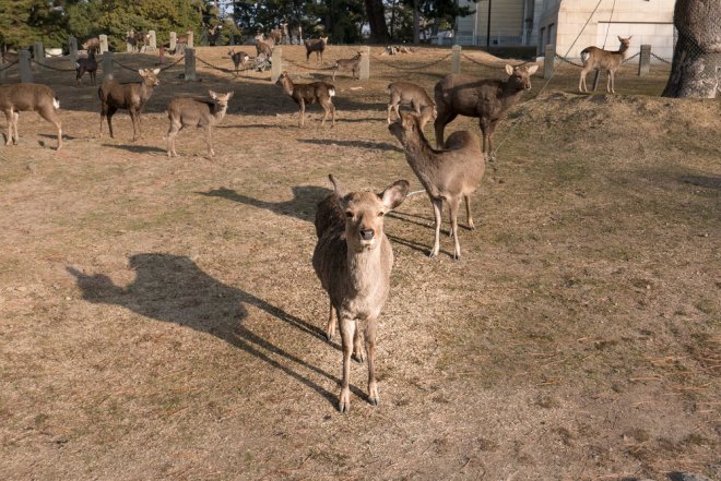
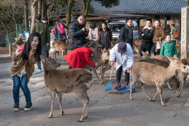
In Nara city I met up with Danny from Kinkicycle and Brad from Fixed in Nara for a coffee and a chat. Nara city is a nice place and if you hook up with Danny or Brad you’ll get an insight into the local cycling scene as you ride around the streets and through Nara Park while avoiding the deer and selfie-stick tourists.
For the return ride I rode from Nara to Tsu. That too failed to produce any inspiring scenery but it was at least lacking in trucks and industrial estates.
To summarize – catch the train or start as far south as possible.
//rwgps-embeds.com/routes/18656860/embed?privacy_code=GKhHXdLlUcLDCKlB
Kasugai – Nara 156km
Elevation gain – 1502m
Hotel – Hotel Nara Annex ¥6200 including breakfast. Don’t bother though, I booked a non-smoking room but they gave me a smoking room despite my complaints.
//rwgps-embeds.com/routes/18656882/embed?privacy_code=LM8haetXuPd5W8WB
Nara to Tsu – 87.5km
Elevation – 1300m
Train from Tsu to Nagoya – ¥1010 for the local train.
2017 & Trip to Australia
Happy New Year.
For BikePackingJapan.com last year was simply an experiment to see if this blog concept had any life in it and I’m happy to say I’ve had numerous emails regarding bike packing and cycle touring in Japan. My aim for 2017 then is to ramp up the content and make the website a solid resource for anyone wanting to experience Japan by bicycle. More on that below.
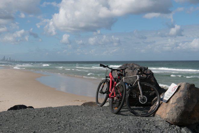
Apologies for the absence of recent posts, I’ve recently taken a few months off bike packing here due to the winter weather (not a valid excuse I know!), a cycling-related injury (lower back problem), and a two week trip to Australia. However, I did ride a couple of times solo into central Gifu and also with a friend but it has been the trip to Australia that has stood out since I last went bike packing in the Nagano/Gunma mountains.
This is a website devoted to cycling in Japan so I’ll keep it brief before moving on to general aims for 2017, but wow! if you’re a cycle commuter in Australia you have it made. Seriously. Wonderful cycle paths, fairly courteous drivers, and laws to protect the cyclists. I never felt unsafe once while cycling in Brisbane and on the Gold Coast. I’ve heard Sydney is different but I haven’t ridden there so can’t say. I also rode in the hills west of the Gold Coast and northwest of Brisbane. It was a lot of fun going off the beaten track, despite the heat, and exploring some of the gravel/dirt roads that seem to be everywhere satisfied the longing for adventure that most cyclists crave. I tried not to get carried away as I didn’t know either area particularly well and the last thing the Australian rescue services needed was another lost Brit in the bush in the middle of the scorching summer. Taking the Fairdale fitted with new Hunt 4 Season Gravel wheels and Schwable G-One tubeless tyres was a great decision. It meant I could ride pretty much anywhere I wanted without having to worry about punctures or getting stuck on difficult trails.
Anyway, back to Japan. In 2016 I mostly concentrated on the central regions – Nagano, Gifu, Ishikawa, Aichi, Mie – but for 2017 the plan is to ride further afield and for longer. Nara and Wakayama prefectures in particular are easily within range of Nagoya and have plenty of mountains to explore, and in Wakayama’s case, numerous coastal villages too. Way back in 2001 I lived in Shikoku and the isolation of Japan’s smallest main island is also something that needs to be revisited in the near future.
It goes without saying that Hokkaido is on the list too. I just need to find the time.
I’d also like to find someone else to collaborate with so that it becomes easier to cover more parts of Japan. If anyone is interested please get in touch.
All the best for 2017 & keep pedaling.
Common Questions & Answers
I’ve added a basic questions and answers post to address common questions that cyclists coming to Japan may have.
You can find it here. If you have any more questions don’t hesitate to leave a comment over on the page, likewise if there’s something I’ve missed.
Kii Nagashima to Shima
![]()
![]()
![]()
![]()
![]()
![]()
![]()
![]()
![]()
![]()
![]()
![]()
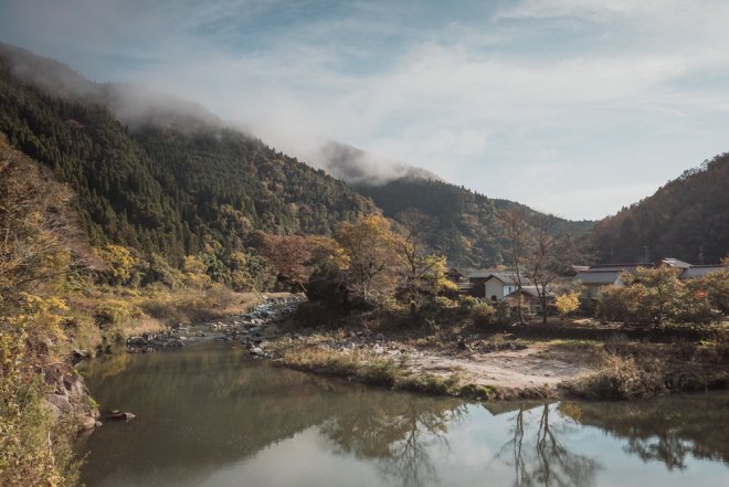
With winter approaching and the higher mountains seeing the first snowfall of the season late autumn to early spring is a good time to head towards the Pacific Ocean coast to enjoy a change of scenery. Coastal villages, quiet fishing ports, shorter but punchy climbs, fresh seafood and majestic ocean views are abundant throughout the Japanese coastal areas and the Kii Peninsula (紀伊半島) – only a couple of hours train ride away from both Nagoya (名古屋) and Osaka (大阪) – provides all of the above.
The route from Kii Nagashima in Mie prefecture (三重県) to Shima (志摩市), host to the 2016 G7 Summit, is a great way to spend a single day riding or as part of a larger multi-day tour. If you’re on a longer bike trip from Tokyo (東京) to Osaka for example, you will probably have considered this route anyway as it’s only a short ferry ride from Irago (伊良湖岬) in Aichi prefecture (愛知県) across the Ise Bay (伊勢湾) and doing so avoids most of the built up areas around Nagoya. Ise Grand Shrine (伊勢神宮), one of the most important shrines in Japan, is also nearby and well worth a visit.
The route below was actually ridden a couple of years ago but I have chosen to post it now due to a niggling back injury meaning I have not done any bike packing since Hafudake (破風岳) in October (keep those muscles stretched people!). Better to post an older route now than disappear into the blogging void.
I rode it by starting in the west and heading east but it can just as easily be ridden from east to west. There’s a section of old disused road starting at 58kms that is not really suitable for road bikes but this can be avoided by staying on R260. If I rode it again that’s what I’d probably do. Bring lights as there are plenty of small tunnels that are unavoidable.
Distance – 102kms
Elevation – 2280m according to Ride With GPS but that doesn’t take into account the tunnels. In reality it was a lot less.
Approximate train fare – ¥4920 from Nagoya to Kii Nagashima / ¥4200 Osaka – Kii Nagashima / ¥3180 Nagoya – Shima-Shimmei
Camping – N/A as I rode it on a day trip
//rwgps-embeds.com/routes/6084044/embed
If you would like a copy of the route file either download it via RWGPS or leave a comment below.
Matsumoto – Hafudake – Kusatsu
One of the benefits of living in central Japan is that most places are within a reasonable distance in relation to cycling and bike packing, and with the JR Chuo line (中央線) running from Tokyo (東京) to Nagoya (名古屋) around the Minami Alps it doesn’t take much time and effort to get out into the mountains.
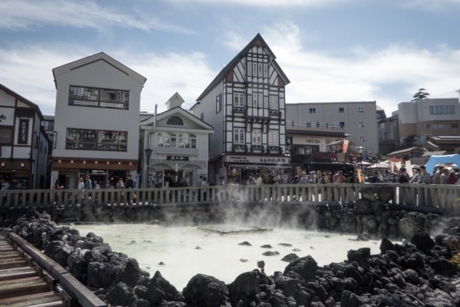
For this trip I wanted to head to the southern tip of the Kita Alps (北アルプス) so planned a route that started in Matsumoto (松本) – an easy train ride from Nagoya on the Chuo line – northeast towards Mt. Shirane (白根山), a currently active volcano, before heading down to Kusatsu Onsen (草津温泉) famous for its outdoor hot spring and onsen resorts.
As I was fairly new to the area I contacted Julien at Fairmean who regularly camps out in the region, and Adam from Ride Japan to get some advice on places to sleep, as well as to confirm whether some roads were open. Julien recommended sleeping at the top of Hafudake (破風岳), southwest of Mt. Shirane, while Adam confirmed that the Manza Highway (万座ハイウェイ) would probably be open. I planned on taking the R292 up and over Mt. Shirane, but if that was closed I could make a detour on the Manza Highway.
The ride from Matsumoto to Hafudake was fairly straightforward with only a couple of average climbs to conquer before the final more challenging ascent to Hafudake at 2000m which would be where I would sleep for the night. A cycle path runs along the Chikuma River (千曲川) in Nagano (長野) that you can follow to get the the base of the final climb. It’s easy to follow but you do have to detour at times and use the much busier R403.
At 2000m the temperature would be roughly 20C cooler than at sea level so, along with a sleeping bag and mattress, I packed two jackets, a winter cycling hat, gloves, and other cycling gear that are usually put aside for the colder months. In the evening it all got worn and I was glad I brought them along as the bivvy bag recently ordered from Locus Gear hadn’t yet been delivered and the temperature at the top was close to freezing.
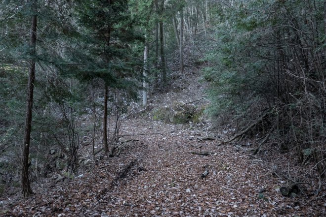
I arrived at the summit after sunset after choosing to take a forest road (林道) in Takayamamura (高山村) that was closed off to normal traffic. Before leaving I’d checked the route and distance of the road and noticed on Google Street View that it was all gravel. I managed to ride about half of it on my bike but had to push the rest. In hindsight, an MTB or even fatbike would have been much better on parts of the trail and it definitely fell into the Type 2 category of adventure activities. Next time, however, I will use the other road a few kilometers northeast that is open to normal traffic.*
After setting up my mattress and sleeping bag it was time to settle down for the night behind a large rock to shelter from the wind. Fortunately it was a fairly calm night and sleep came easily. As it was almost a full moon that evening it meant the night sky was too bright to get a good glimpse at the stars so for future visits it would be a good idea to check the phase of the moon before planning a trip. I don’t have the ability to put into words how it feels to sleep alone at the top of a mountain under the stars – just get out there with the appropriate equipment and give it a try.
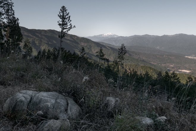
The view first thing in the morning was simply stunning with nothing but mountain ranges as far as I could see south. It still amazes me that in a fairly small country that has a population of 120 million with one of the highest population densities in the world, if you know where to go, you can be alone in the wilderness with nobody around for miles. While camping on top of Hafudake it’s hard to imagine that places like Tokyo, Osaka, and Nagoya exist.
After spending a good hour or so admiring the view and packing up it was time to head east towards Manza (万座) across into Gunma prefecture (群馬県) to wait for the gate to open at 8 a.m. so that I could take the R292 over Mt. Shirane and down into Kusatsu. Mt. Shirane is active and as of writing there is an alert in place so it’s important to check beforehand to make sure that the road is open. No pedestrians are allowed (there are signs in English) and cars are not allowed to stop. Environmental agency personal are scattered along the road too keeping one eye on the volcano, and another on the car day-trippers.
The decent into Kusatsu from the summit reminded me of the upper slopes of Mt. Norikura (乗鞍) – open, winding, breathtaking views, and fast! Unlike Mt. Norikura though, the R292 is open to regular traffic so you need to descend with care. Motorbikes, as usual, can often be a nuisance.
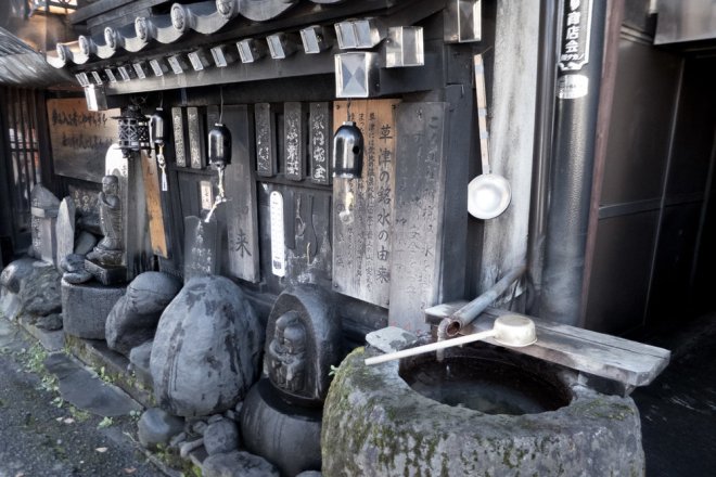
The road will drop you off in the centre of Kusatsu which has ample coffee shops, convenience stores, restaurants and more to freshen up and relax after a solid weekend in the mountains.
Getting back to Nagoya is a more of a hassle from Kusatsu as I had to take a bus to Karuizawa (軽井沢) , the Hokuriku Shinkansen (北陸新幹線) to Nagano (長野), and then the JR Shinano on the Chuo line back home. Getting to Tokyo is much easier as there are more regular buses to Shinjuku (新宿).
*The route below does NOT include the gravel/forest road but instead goes up the normal road open to traffic.
Distance – 140kms (over two days)
Train fare – Between ¥3000 – ¥6000 depending on which train you take.
Elevation gain – 2000m
Campsite – rough camping at the top of Hafudake.
//rwgps-embeds.com/routes/17237620/embed
Want the files for any of our routes? Get in touch and we’ll be happy to send them.
